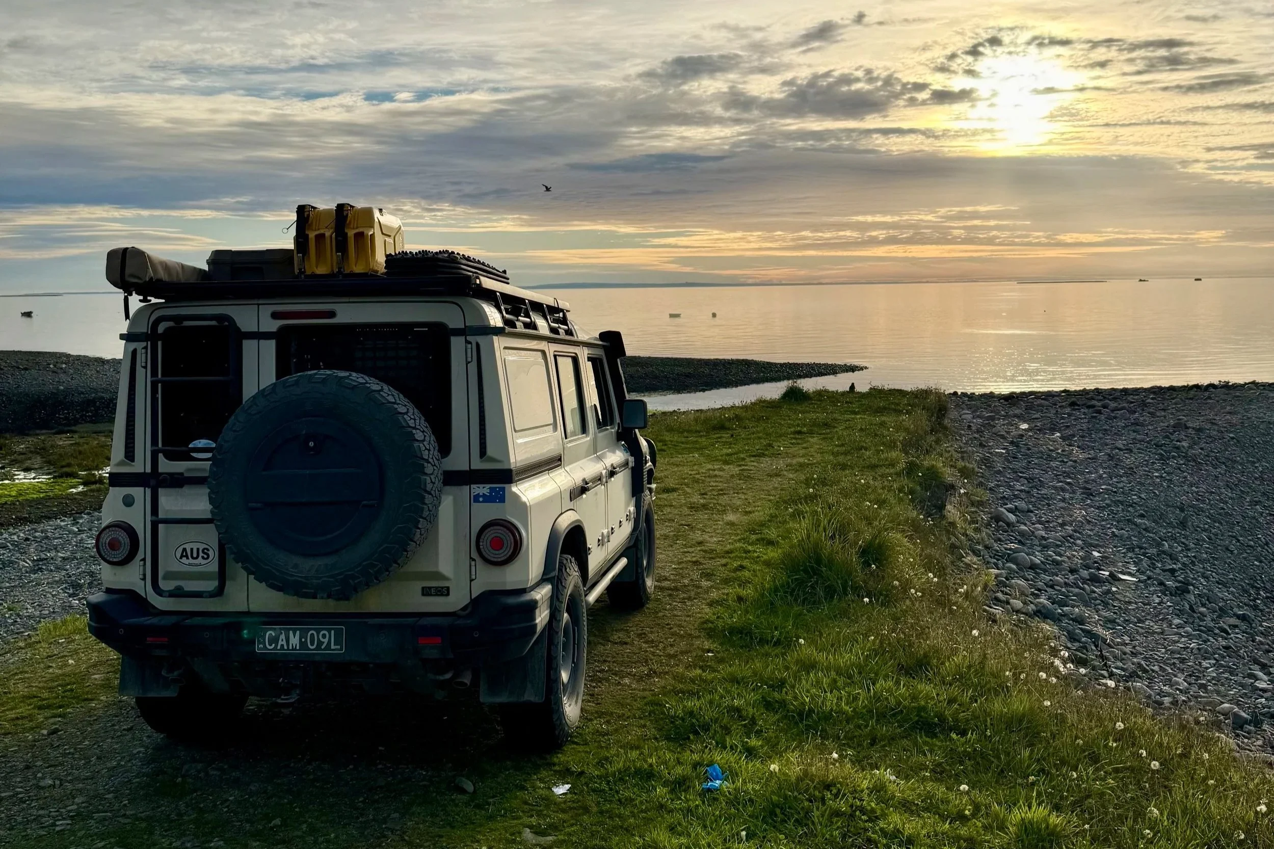
Panamericanos on the Carretera Austral
Heading north on Ruta 40 from El Chaltén toward Estancia La Angostura we met Albert, a Dutch motorcyclist riding the Pan-American Highway from Alaska to Ushuaia on his Ducati 998. His bike, shaken by severe corrugations, was having electrical issues. We jump-started him with a battery booster and he continued on his way. Albert personifies the adventurous and eccentric spirit of the Panamericano: the road draws a certain kind of person, and not all of them arrive in the obvious vehicle.
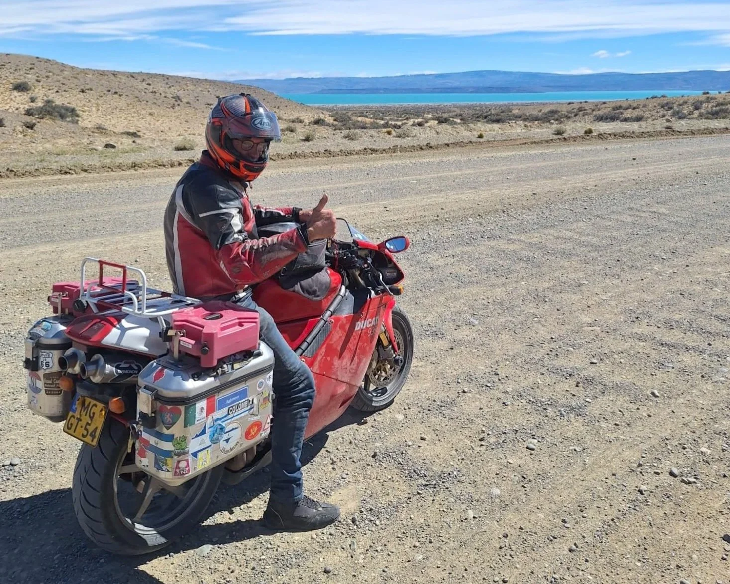
Albert is good to go
From Estancia La Angostura the crossing into Chile via Paso Rodolfo Roballos is a remote one, and the road from the paso joins the Carretera Austral via Patagonia National Park — the Chacabuco Valley, an east-west corridor through the Andes that opens into a wide steppe running toward the Argentine border.
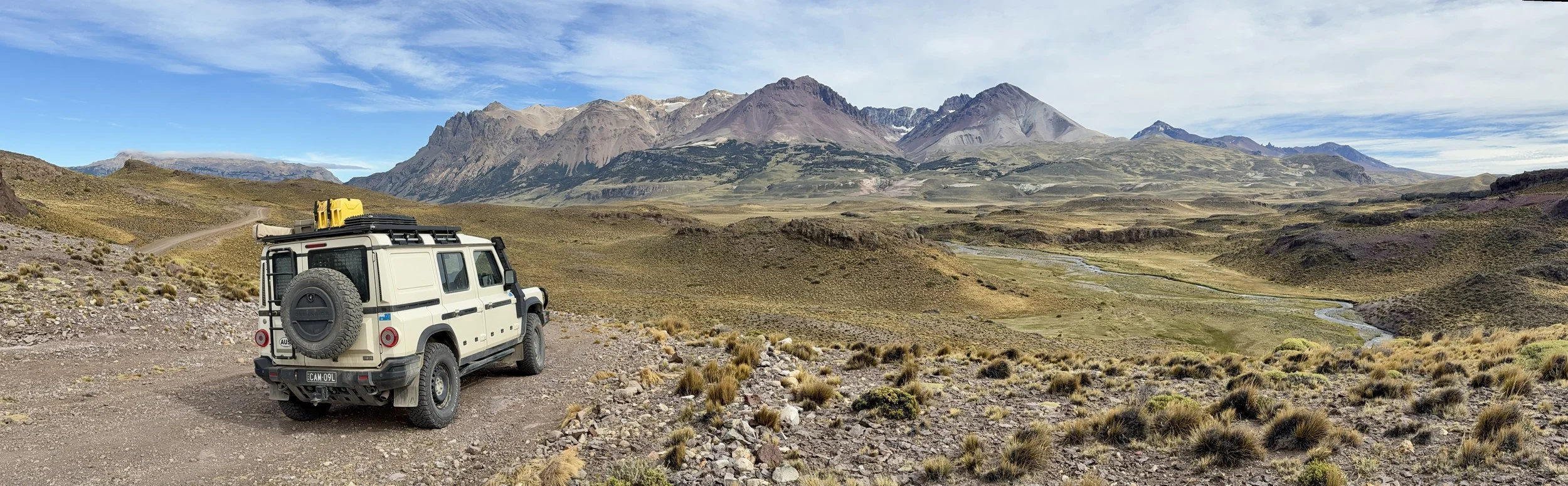
Chacabuco Valley
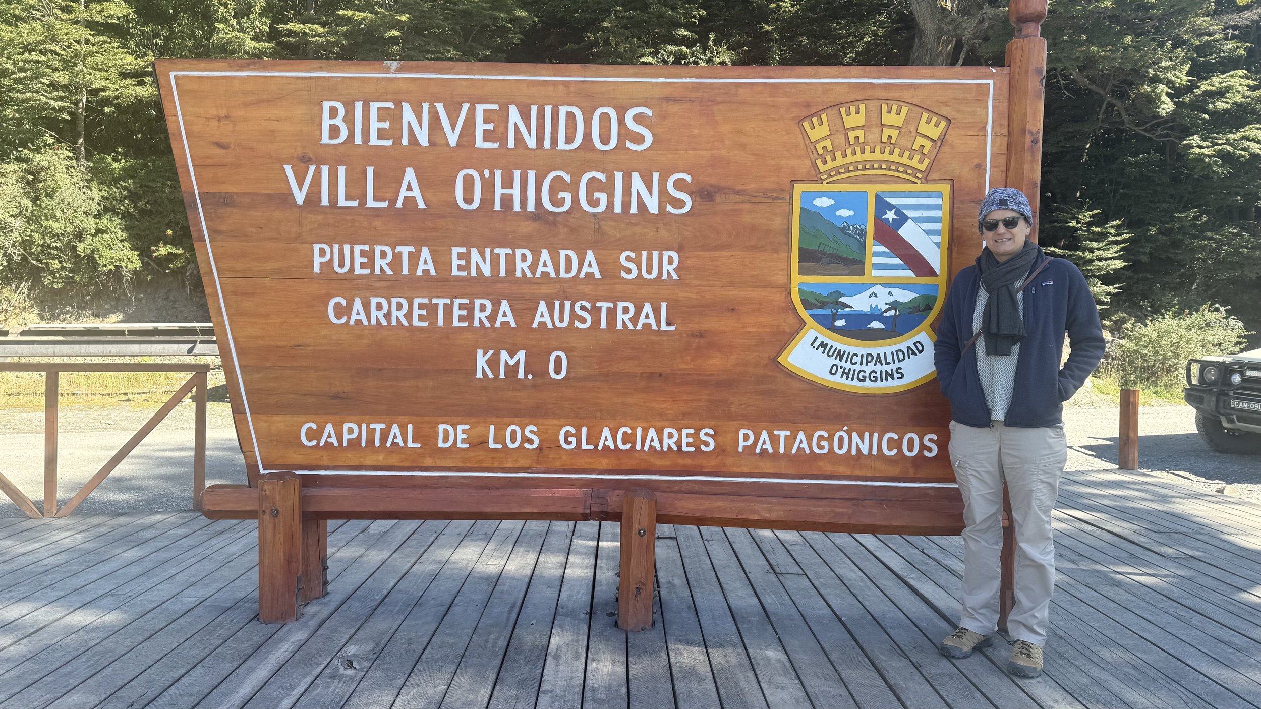
The Carretera itself runs 1,240 kilometres from Puerto Montt to Villa O’Higgins, unpaved for significant stretches. We drove it southbound first, stopping in Cochrane — a small ranching town that functions as a southern supply point — before continuing to Villa O’Higgins at the road’s end, then drove it northbound in its entirety.
Villa O’Higgins
The road south to Villa O’Higgins required a ferry crossing on the Río Bravo. The town, the lake it sits on, the glacier that feeds it, and the national park that extends south toward Torres del Paine all carry the same name — Bernardo O’Higgins, whose presence is woven into Chilean geography from the main boulevard of Santiago to the terminus of the southernmost road in the country. It is a remarkable reach for a man who was born illegitimate, whose father was a Spanish officer from County Sligo in Ireland, and who spent his early years unacknowledged and his later ones in exile. Villa O’Higgins itself is the end of maintained road in this part of the world. From Bahía Bahamondes, a short drive beyond the town, you look south over water and there is nothing further to drive to. We had coffee and cake, walked up the hill behind the bay, and turned north the following morning.
Southern end of the Carretera Austral a few kilometres past Villa O’Higgins
The Carretera northbound
Puerto Río Tranquilo sits on Lago General Carrera — one of the largest lakes in South America — where the marble caves at the lake’s edge are accessible only by boat. The turquoise glacial water refracts off the marble walls in a way that makes the light appear to come from the stone itself. Two nights here, the second largely rained in. Coyhaique is the largest settlement on the Carretera, with a population of around 60,000 and the logistics infrastructure that implies.
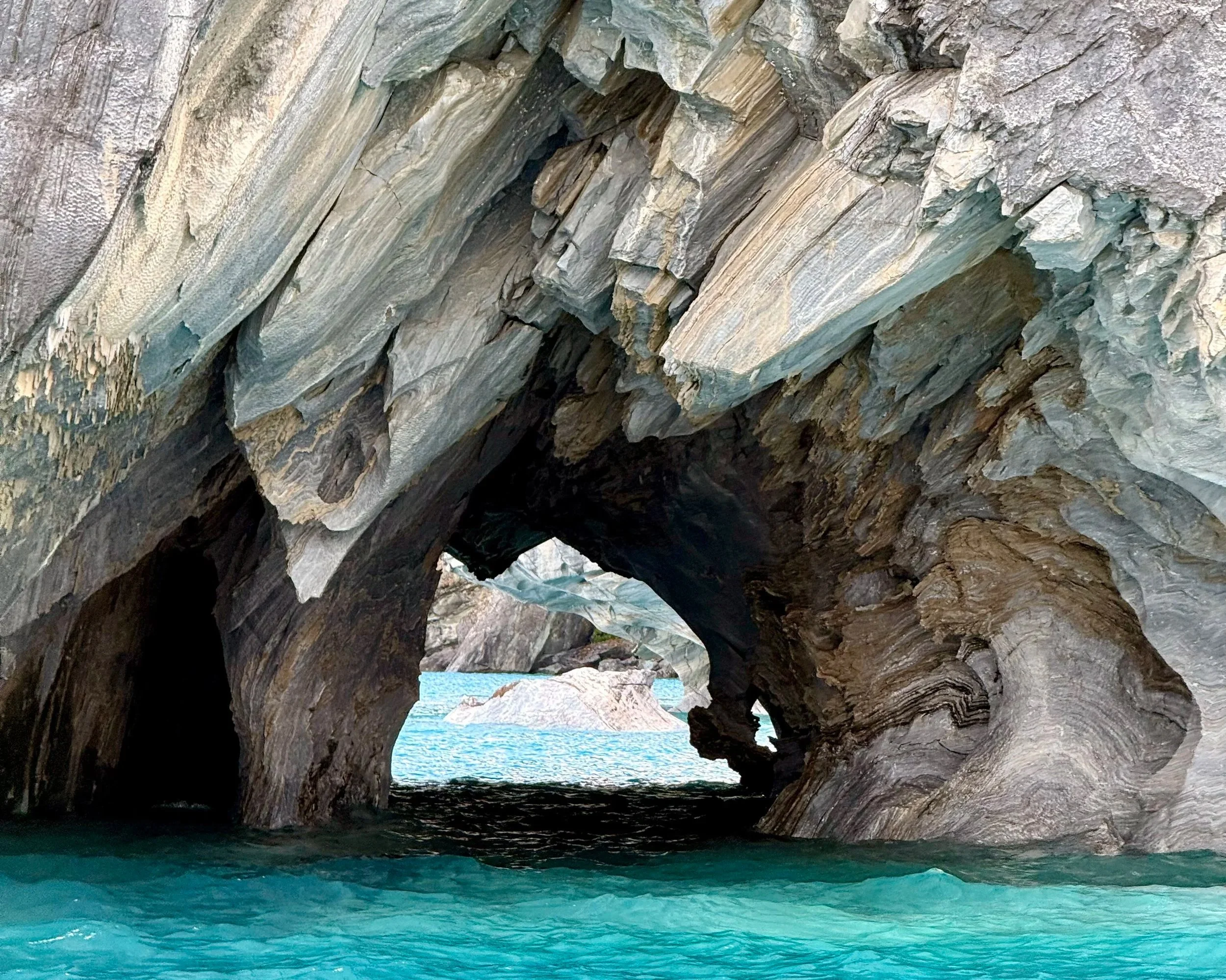
Marble caves at Lago General Carrera
Puyuhuapi is a small fjord village with an unlikely origin: founded in the 1940s by four young Sudeten Germans who arrived by boat having read about settlement opportunities in Patagonia. From there we spent two days in Queulat National Park. Queulat means “sound of waterfalls” in the language of the Chono people. The Ventisquero Colgante — the hanging glacier — is the park’s centrepiece: a mass of ice suspended in a cirque above a vertical rock face, calving into a waterfall that drops to a glacial lagoon below. The scale defeats photography; you stand on the suspension bridge over the Ventisquero River and look up at something that seems structurally improbable. If we had a favourite section of the Carretera, this was it — though not primarily for the glacier.
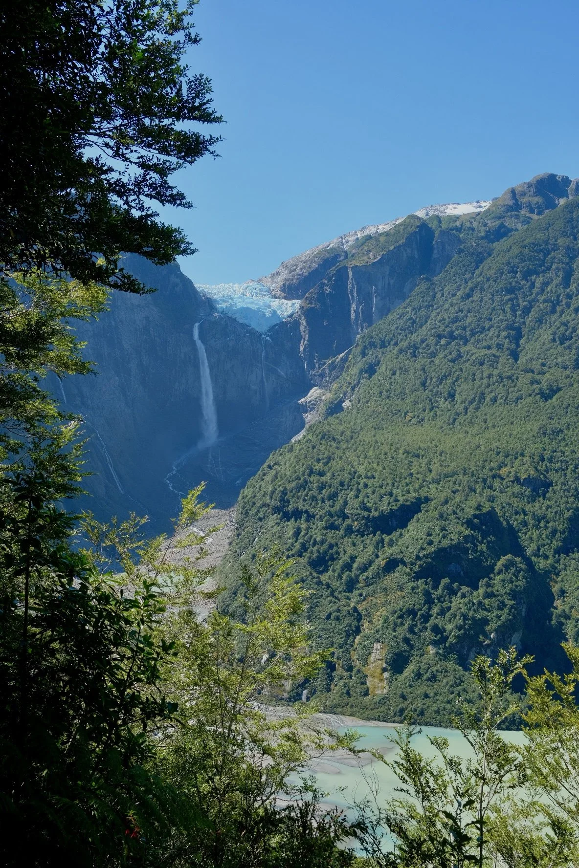
Approaching the hanging glacier at Ventisquero Colgante
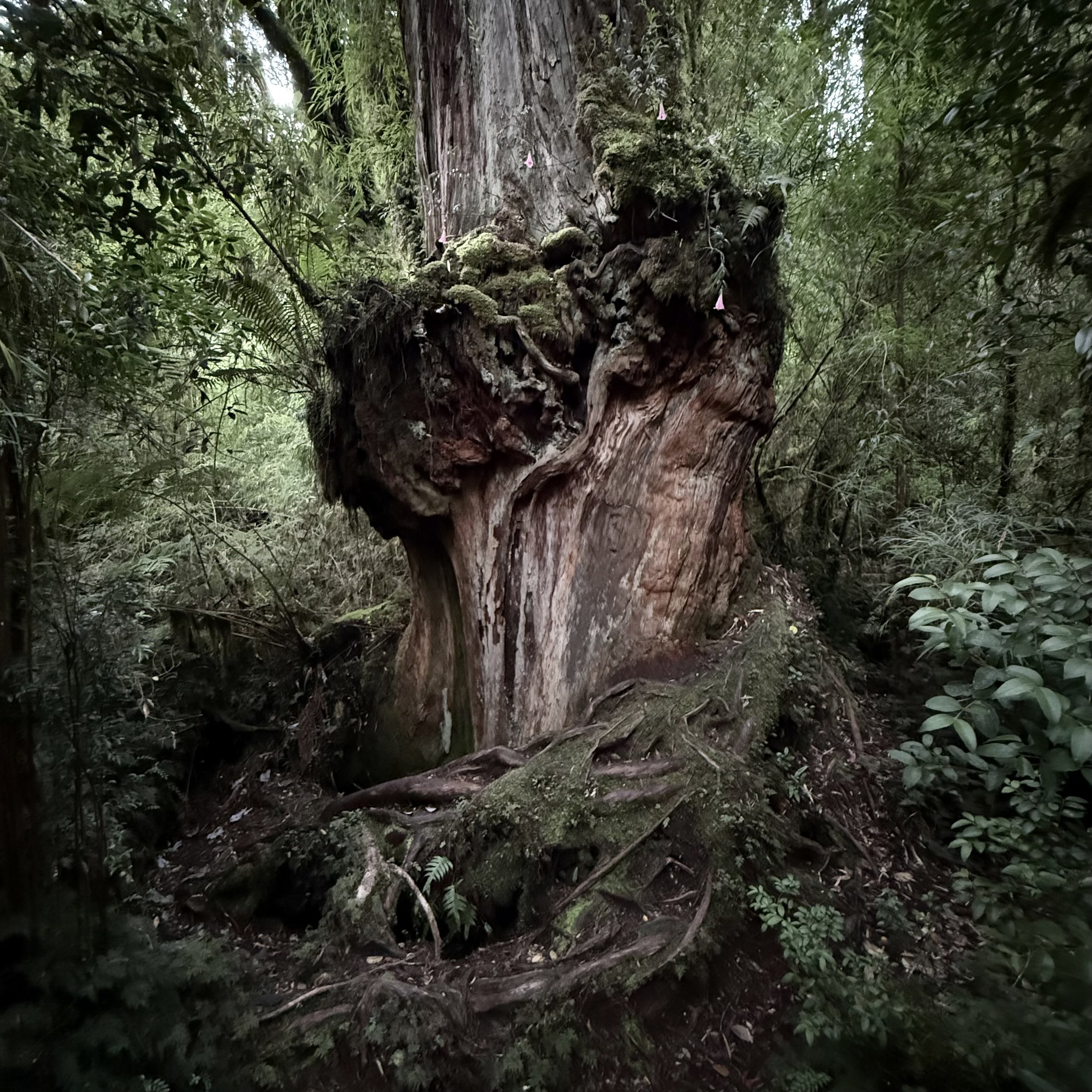
The forest was the more extraordinary thing. Queulat receives up to 4,000 millimetres of rain annually, and the result is a Valdivian rainforest of near-total density — coigüe, tepa, and tepú forming the canopy, nalca colonising every wet surface below with leaves that can reach a metre across, ferns and mosses occupying every available layer. The chucao tapaculo announces itself loudly from the understory and shows itself rarely. The kodkod — the world’s smallest wild cat, entirely dependent on old-growth forest — lives here, though not for the looking. This is forest that has been continuous for 200 million years, surviving the glaciations that buried everything around it, a direct descendant of the Gondwanan system that once connected South America, Antarctica, and Australia. It is still largely as it was.
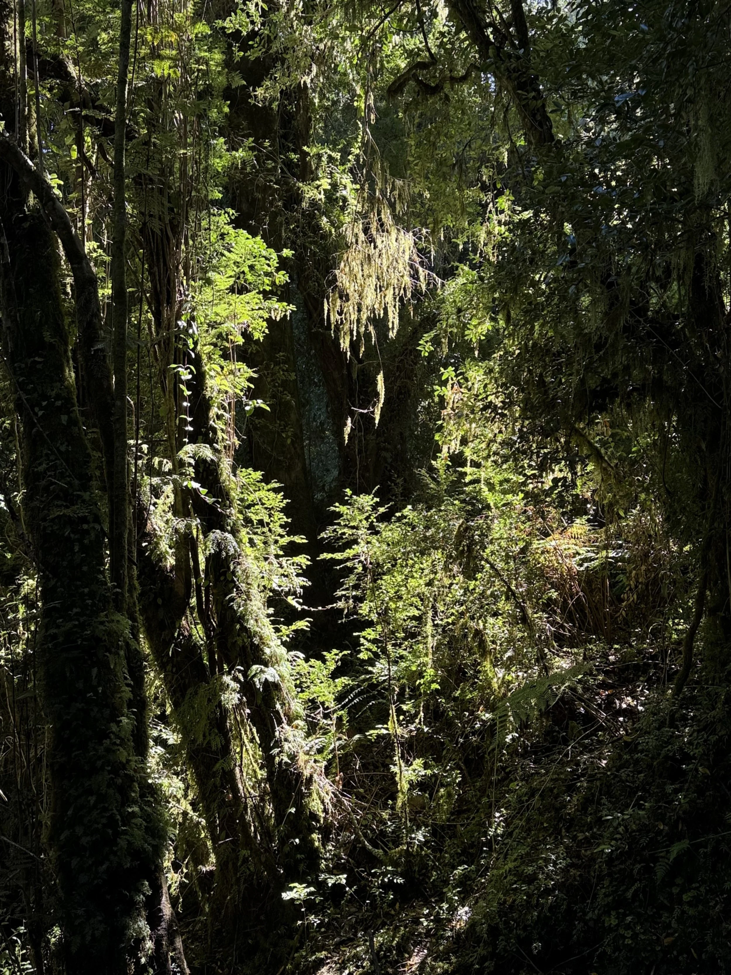
Deep in the verdant Quelat forest
Continuing north, Chaitén was largely destroyed when Volcán Chaitén erupted in 2008 after nearly 10,000 years of dormancy — ash plumes reached 30 kilometres, lahars inundated the town, and the government declared it uninhabitable and ordered the permanent relocation of all 5,000 residents. The residents refused. They returned and rebuilt in place, against official policy. The lahars diverted the Río Chaitén permanently through the centre of town; the river now bisects it, with the rebuilt town on one side and the flood-destroyed section on the other.
Rewilding Chile via the Tompkins Conservation
South of Chaitén lies Pumalín Douglas Tompkins National Park, nearly a million acres of Valdivian temperate rainforest and the culmination of a project that began here in 1991. To understand Pumalín — and the wider transformation it belongs to — you need to know who Douglas and Kristine Tompkins were and what drove them. Douglas Tompkins founded The North Face in San Francisco in 1964 and later co-founded Esprit, which by 1989 had revenues of a billion dollars and operated in 60 countries. His second wife, Kristine McDivitt, was CEO of Patagonia, Inc. — the outdoor brand founded by climber Yvon Chouinard, whose logo depicts Mount Fitz Roy, the Patagonian peak that Tompkins and Chouinard first climbed together in 1968 on a road trip south from California. The landscape that would become Tompkins’s life’s work was the same landscape that gave Chouinard’s company its name and its image.
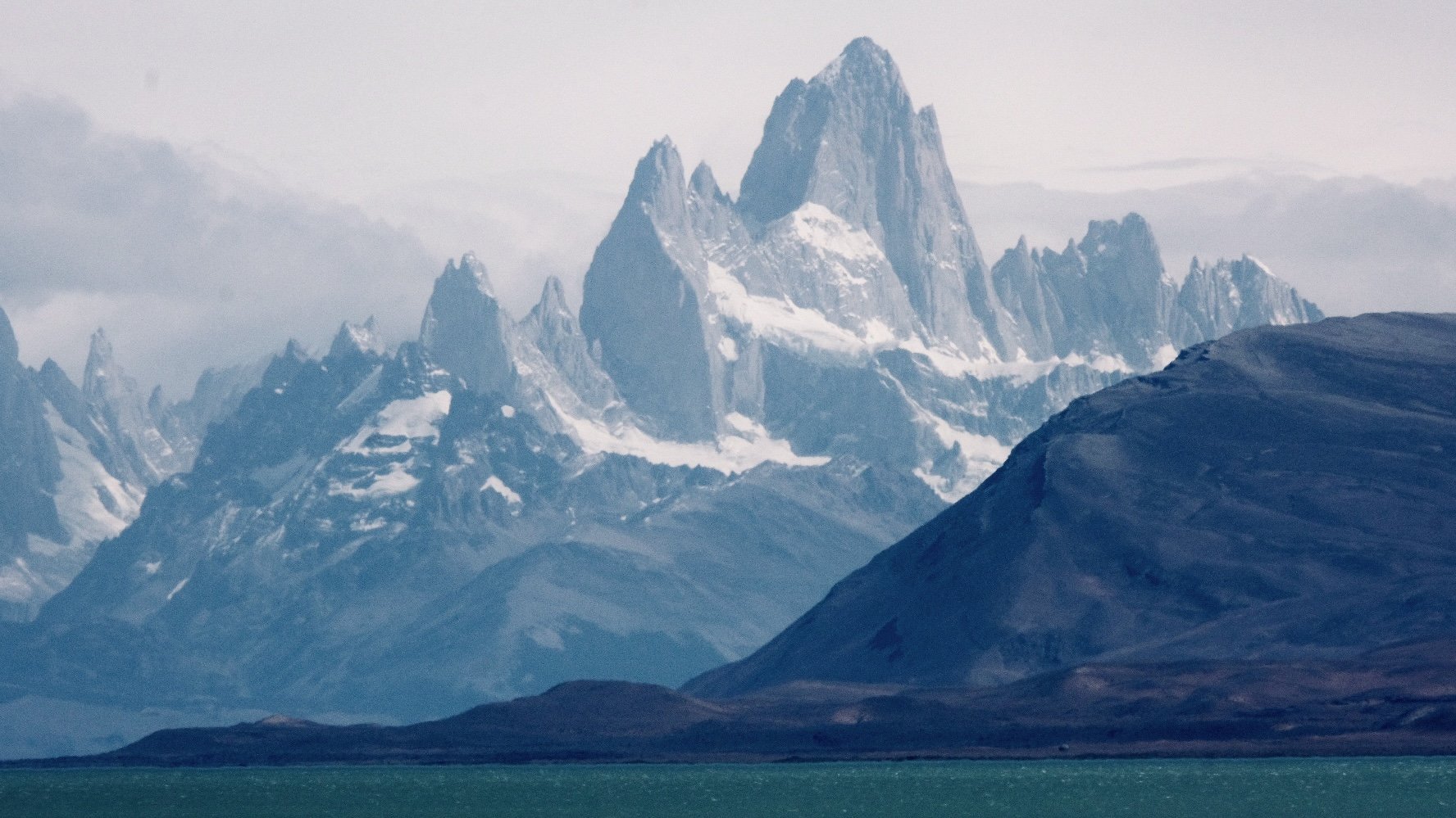
The majestic Mount Fitz Roy
As Esprit grew, Tompkins grew increasingly uncomfortable with what it represented. “I came to realise,” he wrote, “that the production and promotion of consumer products not vital to anyone’s needs were as much part of the eco-social crisis as anything.” He described leaving the business world as paying his “rent for living on the planet.” In 1989 he sold his share of Esprit and moved to southern Chile to begin purchasing land. The intellectual framework was deep ecology — the philosophy associated with Norwegian thinker Arne Naess, which held that shallow, reform-minded environmentalism was insufficient; only a genuinely ecocentric land ethic, treating humans as members of the community of life rather than its masters, could reverse what Tompkins called the rush toward “the dustbin of history.” His first acquisition was a semi-abandoned farm on the Reñihué fjord. Over the following decade, The Conservation Land Trust added more than 700,000 contiguous acres to create what became Pumalín Park. The project attracted fierce political opposition — his landholdings stretched from the Argentine border to the Pacific, effectively bisecting the country, and were described in some quarters as a foreign land grab. Kris Tompkins, meanwhile, had left Patagonia, Inc. and joined the effort. In 2004, their nonprofit purchased the 175,000-acre Estancia Valle Chacabuco — the future Patagonia National Park — with the explicit intention of converting it to public parkland: the first Tompkins project conceived from the outset as a future national park rather than private conservation land. Sheep were removed, 640 kilometres of fencing dismantled, native coíron reseeded across degraded grassland, and guanacos, pumas, condors, and huemul moved back into country they had been excluded from for generations.
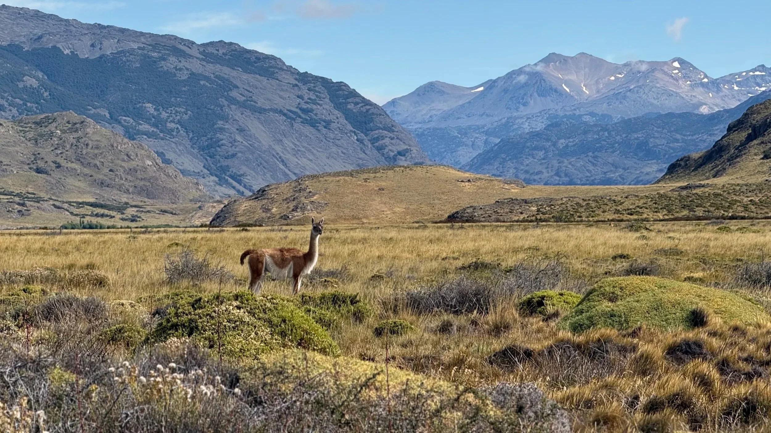
Guanaco roam the Patagonia National Park, thanks to the Tompkins Conservation
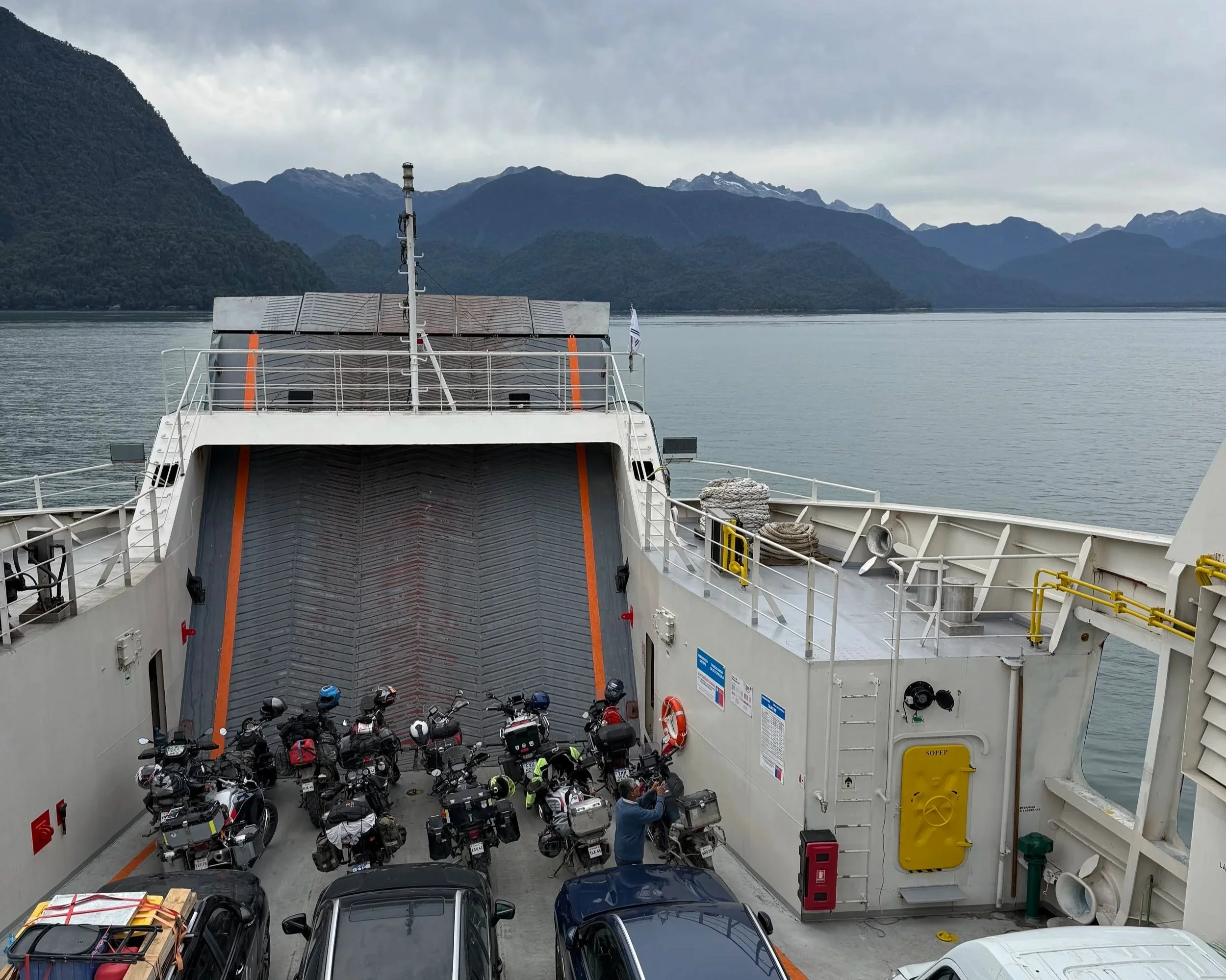
What followed was decades of negotiation, acquisition, and restoration. In 2018, in what was formalised as the largest private land donation in history, Tompkins Conservation transferred over one million acres to the Chilean state, which combined it with government land to create five new national parks — Pumalín Douglas Tompkins, Patagonia, Melimoyu, Cerro Castillo, and Kawésqar — and expand three others. The result is the Route of Parks of Patagonia: 17 national parks, 1,700 miles from Puerto Montt to Cape Horn, 28 million acres, representing 91% of Chile’s nationally protected acreage. Tompkins did not see the final agreement: he died in December 2015 when his kayak capsized on Lago General Carrera during a trip with Chouinard and others, succumbing to hypothermia in the same lake whose marble caves we had visited two days earlier. Kristine completed the negotiation. What these parks protect is older than the parks, older than the continent in its current form, older than the Andes themselves. The Valdivian rainforest survived the glaciation that buried most of this region 14,000 years ago intact, preserving a forest system whose lineage runs back to Gondwana — the same deep ancestry shared with the temperate rainforests of Tasmania, New Zealand, and the NSW escarpment. The alerce — Fitzroya cupressoides, a Gondwanan cypress relict with no close living relatives outside South America — grows in Pumalín, individual trees over 3,000 years old, having germinated before the Roman Empire. The park protects 25% of Chile’s remaining alerce forest. These are not ecosystems being restored to a recent historical baseline; they are fragments of a biological lineage that predates the formation of South America’s present geography. We drove through Pumalín to Caleta Gonzalo for the first of two ferries: Caleta Gonzalo to Hornopirén through fjord channels, then a shorter crossing from Caleta Puelche to Caleta La Arena.
Roots of a >2,000 year old alerce tree
Puerto Varas and the exit
Puerto Varas sits on Lago Llanquihue with Volcán Osorno — a near-perfect cone — visible across the water on clear mornings. The town is prosperous, German-influenced in character, and functions well as both destination and actual town. Two nights, a walk in Alerce Andino National Park, Brazilian visa applied for.
One last ferry and the Carretera was complete
On 10 March we crossed into Argentina at Villa La Angostura, driving the length of Lago Llanquihue with Volcán Osorno behind us. The Carretera was done. The road itself is not technically demanding — much of it is paved, and the gravel sections are manageable — but it is long, and what it passes through is extraordinary: ancient forest, hanging glaciers, fjords, the conservation parks of the Tompkins legacy, the terminus of the southernmost road on earth. The Gondwanan lineage threading the forest, the O’Higgins nomenclature running from the mountain pass to Villa O’Higgins itself: there is more layered into this road than most people realise before they drive it. It has been drawing adventurers from around the world since it opened, and it will go on doing so. The appeal is not the challenge it represents but the wild places it leads to — and there are few roads on earth that offer such spectacular diversity.